
Ecology & Arboriculture
Motus has a unique advantage when it comes to working within the arboricultural industry & around the power networks here in the UK & Australia, our chief remote pilot also a Level 6 consulting arborist has been involved in the arboricultural industry for the last twenty three years globally.
This experience and knowledge places Motus in a unique position to work along side council arborists, vegetation management companies insurance assessors & asset owners in a way that no other drone company can.

Services we
Offer
Virtual Inspections
Virtual inspections are not limited to a power network, these bespoke virtual experiences can be tailored to suit any situation whether that be aerial or ground based and from large scale project areas to smaller personal spaces such as private residences or properties.
We provide you with aerial or ground based footage, that allows you to virtually inspect and monitor an area or even the power network from anywhere with internet access.
Motus obtains the imagery and creates a virtual experience that allows you to view the area or network in a full 360° format.
Below is a virtual network inspection example used by one of our Australian clients when tendering for a powerline vegetation management contract.
Arboriculture & Powerlines
The use of remotely piloted aircraft within the arboricultural, forestry and conservation sector is growing steadily as more people become aware of the ever increasing benefits, possibilities and uses for this relatively new technology. Motus Imaging Solutions can help cut the costs and time it takes to carry out inspections, giving you the edge needed for success
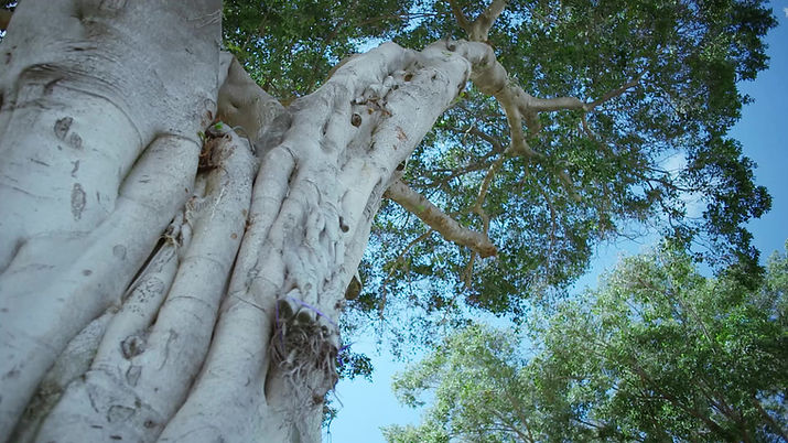
High resolution hazard tree inspections
Tree inspection techniques are ever striving forward with the adoption of drone data making inspections safer, while giving a digital record of the inspection or problem area.
High resolution zoom cameras, thermal cameras, laser range finders and RTK location data are just some of the tools Motus utilises when conducting tree inspections.
Thermal Inspections
Motus delivers the ability to map and monitor stock piles, woodchip piles, green waste and waste areas, giving you the ability to monitor the volumes of waste areas, thermally monitor the heat in waste areas, check for heat spikes which would signify the potential combustion of stockpiles, therefore saving very large insurance claims
Aerial Surveys
Aerial surveys are rapidly replacing traditional survey methods due to the speed, accuracy, outputs, reduction in manpower and costs. With the ability to view a site from the office, check and mange works progression and view historical site data with a simple click you can see why. Motus delivers highly accurate maps and models that are used in works planning, monitoring through to final sign off and completion
When compared to conventional survey methods on a site of 61.76ha, aerial data capture required 75% less time with 50% less man power
Multispectural Analysis Models
Data collected from multispectral cameras is now widely used for monitoring and predicting plant health, this data is used by green keepers, horticulturalists and arborists to aid in keeping parks, golf courses and wildlife areas looking their best and as healthy as possible
Example Multispectral data
Motus provides you with this essential plant health data, and also recommend local consulting arborists who will be able to aid you with tree management plans
 |  |  |
|---|---|---|
 |  |  |
 |  |  |
 |  |  |
 |  |  |
 |  |  |
 |  |  |
Photogrammetry & 3D Modelling
for Vegetation Monitoring
With the ability to accurately measure, annotate, inspect data, calculate volume/areas and drop markers with exact coordinates, photogrammetry and 3D modelling would make the perfect partner to allow companies in the same ecosystem to work together and enables staff to work smarter and with greater impact
In a recent test capture performed by the Motus team, we captured over 2.5kms of powerlines in a fraction of the time it would have taken a power line inspector. This time saving (and risk reducing approach) is combined with the ability to access areas, previously impossible to reach on foot
Wildlife & Habitat Identification
Having the ability to investigate natural habitats has never been so easy as it is today; remotely piloted aircraft are bringing new and exciting possibilities into the wildlife sector, the data we produce is more accurate than traditional ground based data capture methods.
Utilising thermal imaging & high resolution cameras, allows us to spot even the most reluctant wildlife for monitoring purposes. Importantly with the introduction of high resolution zoom cameras we are able to locate and monitor wildlife without being invasive.


Recently our chief remote pilot has been involved in the drone shark spotting program for the DPI (Department of Primary Industry) in conjunction with SLSA (Surf Life Saving Australia), patrolling the beaches from the air, on a look out for potentially dangerous species and assisting with search and rescue missions.
Some of the Motus team following on from the devastating bushfires that ravaged Australia in 2019 & 2020, were involved in a three night expedition to search for injured koalas in the southern parts of NSW.
Utilising the Dji M210 v2 and XT2 thermal camera a grid search was performed at night in the hope of finding the exact locations of injured koalas and wildlife, then the precise coordinates could be given to ground crews to perform the aerial rescue.
The ability to use drones in this space is ever evolving, with people pushing boundaries and only being limited to imagination, from counting penguins in the South Pole to Capturing whale snot in the Sea of Cortez
Thermal Asset Inspection
Drone mounted thermal cameras provide asset owners with the ability to spot areas of the network which are running hot. These hot spots are an indication of faults on a particular part of the asset. Rapid identification combined with accurate mapping, can provide our clients with priority areas for inspection and remedy. This will prove invaluable in bush-fire prevention going forward
These high quality thermal cameras are also able to be used for any asset inspection that produces a heat signature, from finding leaks in building roofs, equipment drawing too much current and over heating all the way to wild life and conservation
